Great read from Jane Macfarlane Director of the Smart Cities Research Center at the University of California Berkeley’s Institute of Transportation Studies, where she works on data analytics for emerging transportation issues.
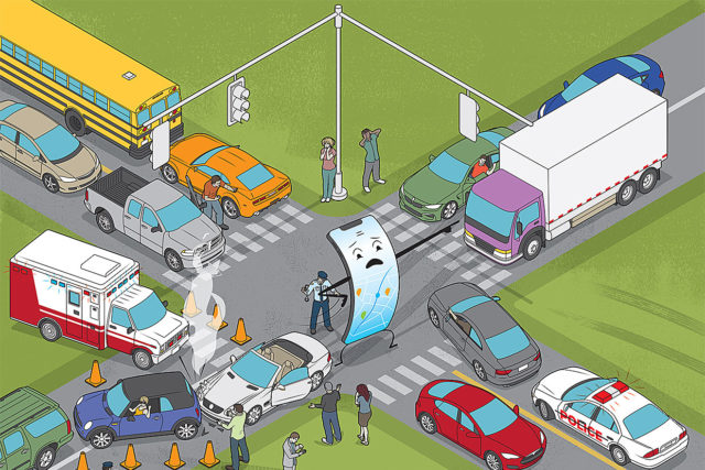
“Miguel Street is a winding, narrow route through the Glen Park neighborhood of San Francisco. Until a few years ago, only those living along the road traveled it, and they understood its challenges well. Now it’s packed with cars that use it as a shortcut from congested Mission Street to heavily traveled Market Street. Residents must struggle to get to their homes, and accidents are a daily occurrence.
The problem began when smartphone apps like Waze, Apple Maps, and Google Maps came into widespread use, offering drivers real-time routing around traffic tie-ups. An estimated 1 billion drivers worldwide use such apps.”
Keep reading at IEEE Spectrum – here.
MOST COMMENTED
Apps / Mobile OS / Smart routing / Software
Your Navigation App: Waze, Apple Maps, and Google Maps is causing chaos and Making Traffic Unmanageable
Apple / iOS / Mobile OS
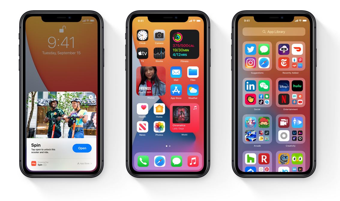
iOS 14 is available as of September 16th, 2020
Insurance / IoT / UBI - Usage Based Insurance
Growth of Connected Insurance
Android / Android Automotive OS / Autos / Car OS / Electric Vehicles / Software
Android Automotive OS – Provides the Smarts for New Polestar 2 Electric Sedan